
Hi, I'm Sandi RizqiFull Stack Web and Machine Learning Developer
GIS (Geographic Information System) and Geo-Artificial Intelligence practitioner with over 5 years of experience. Adept at developing cutting-edge spatial data processing and analytics technology, combining web, GIS, and artificial intelligence to drive efficiency and innovation
Featured Projects
Web-GIS
Developed a full-stack Web-GIS platform leveraging Next.js, Django, and microservices to deliver scalable geospatial data management and visualization on AWS.
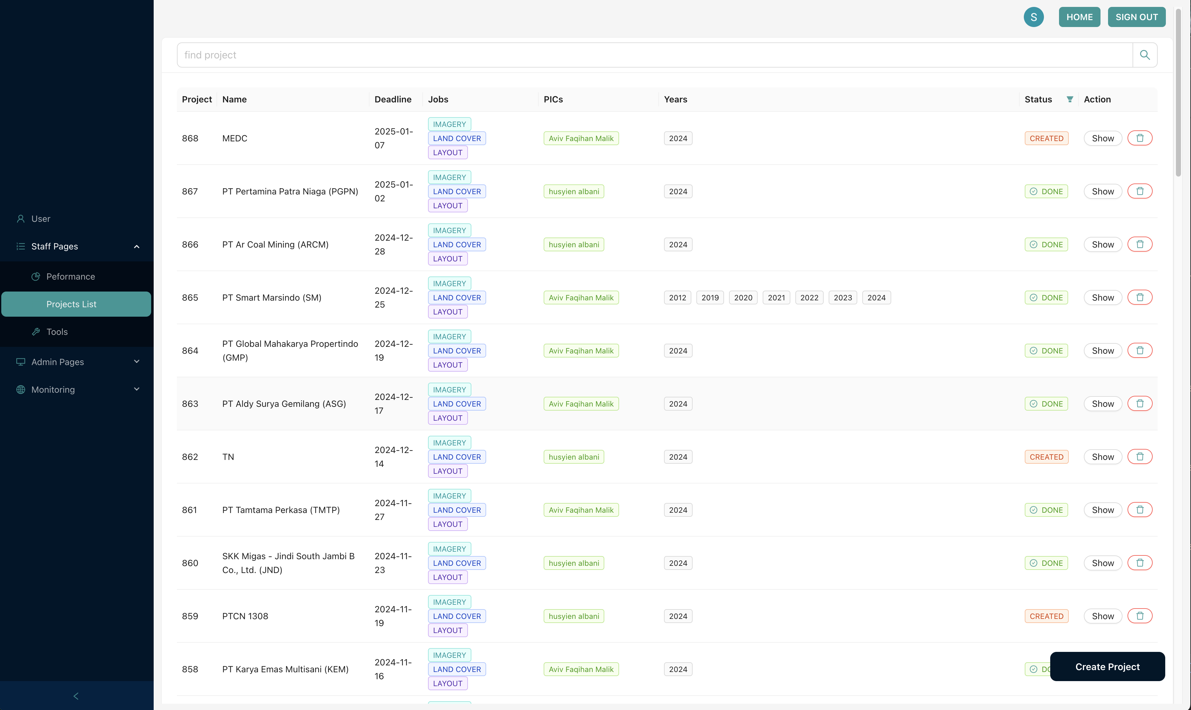
Task Management App
Built a collaborative task management application with React and Firebase, enabling efficient project tracking and performance monitoring across teams.
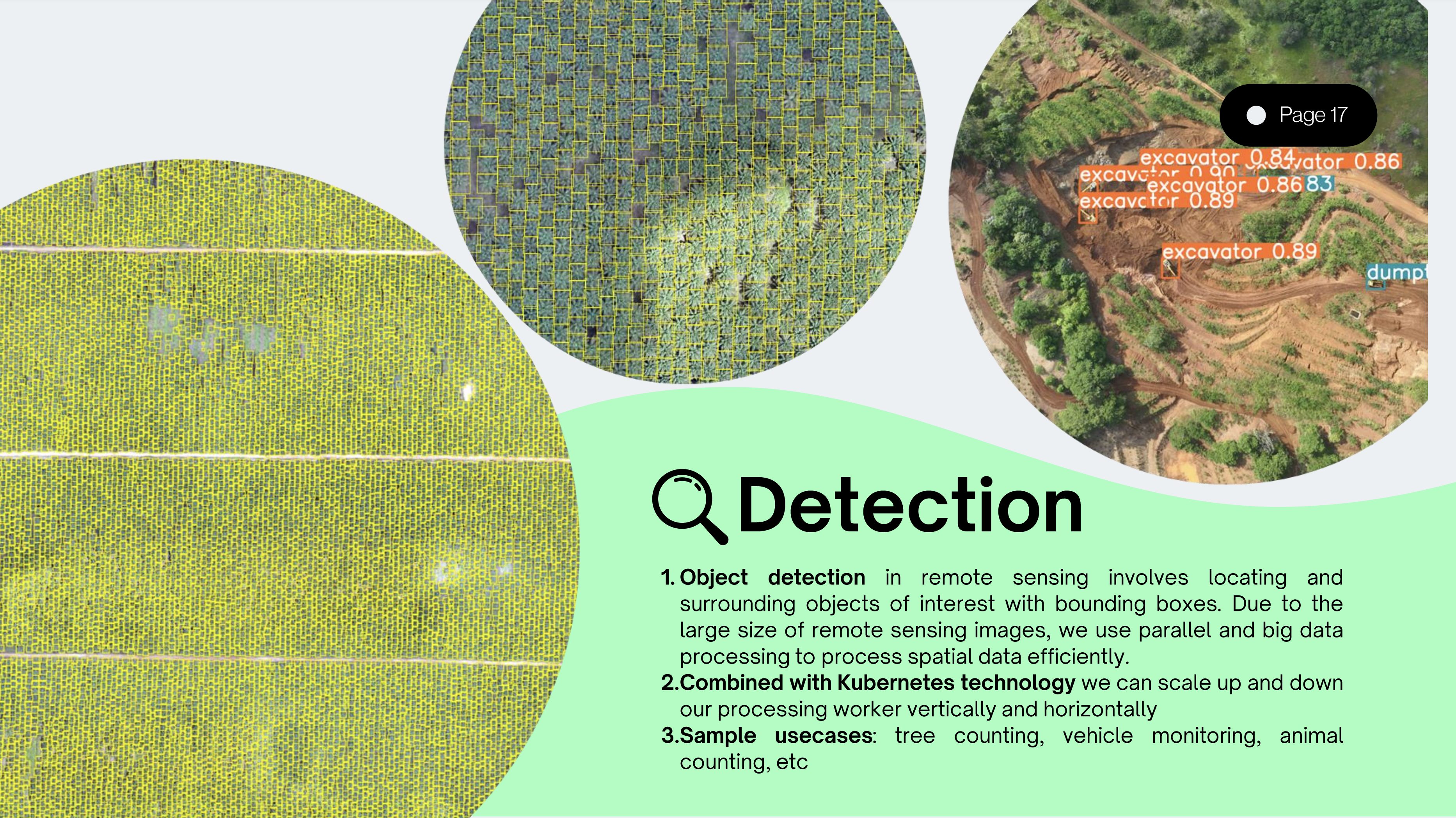
Machine Learning App
Designed and implemented geospatial machine learning solutions using PyTorch and Scikit-Learn, deployed on Kubernetes and Docker for scalable model serving.
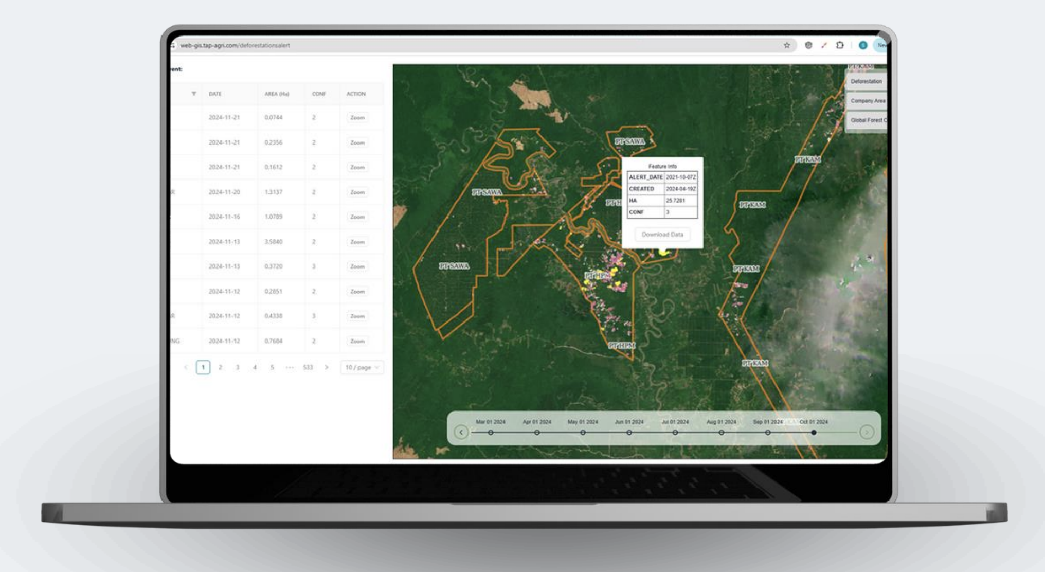
Monitoring & Alert System
Engineered a real-time monitoring and alert system for forest fire hotspots and deforestation, powered by microservices and scalable Python-based backend.
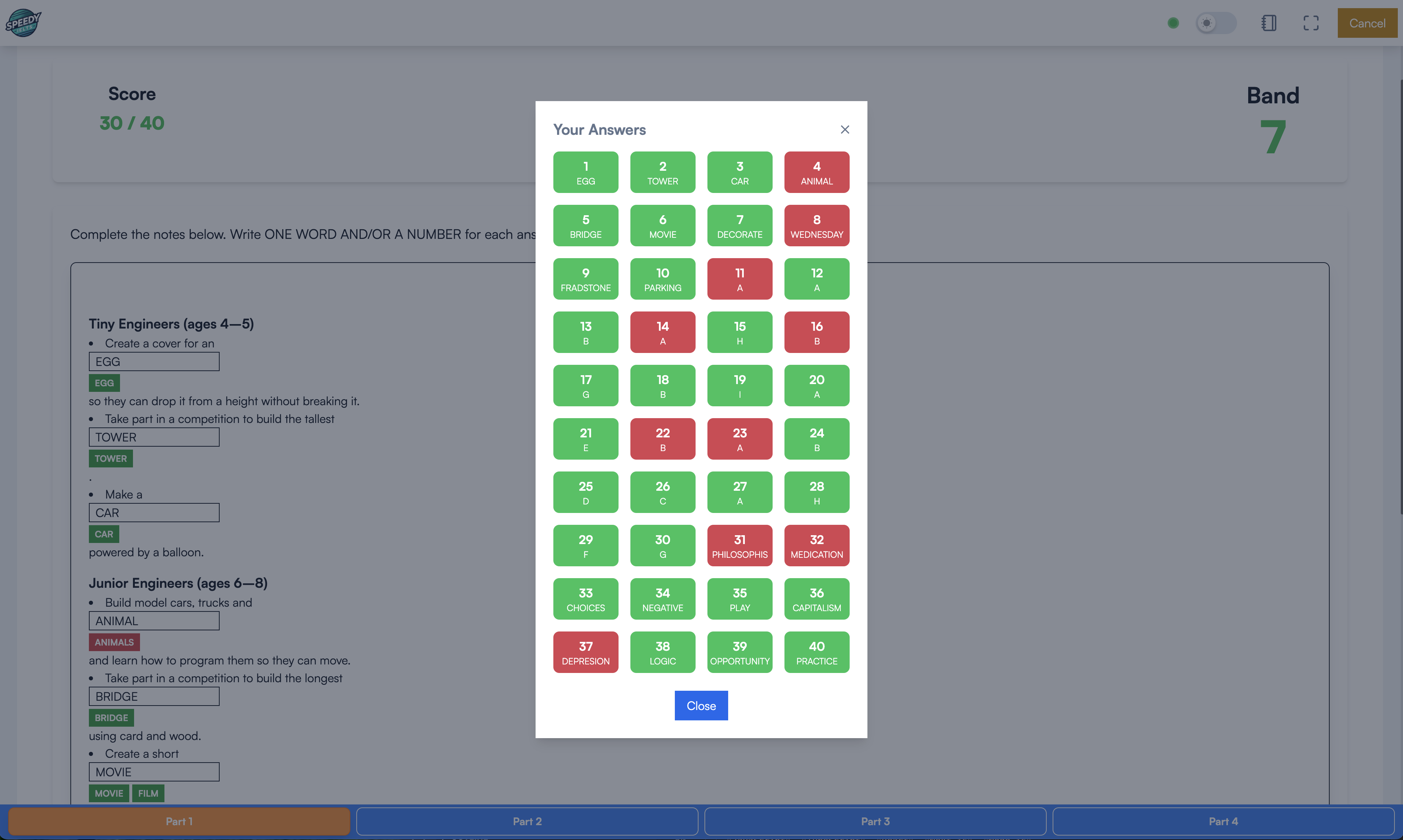
IELTS Simulation Platform
Developed an AI-powered online platform simulating all four IELTS skills, integrating Next.js with Generative AI to provide realistic and interactive test experiences.

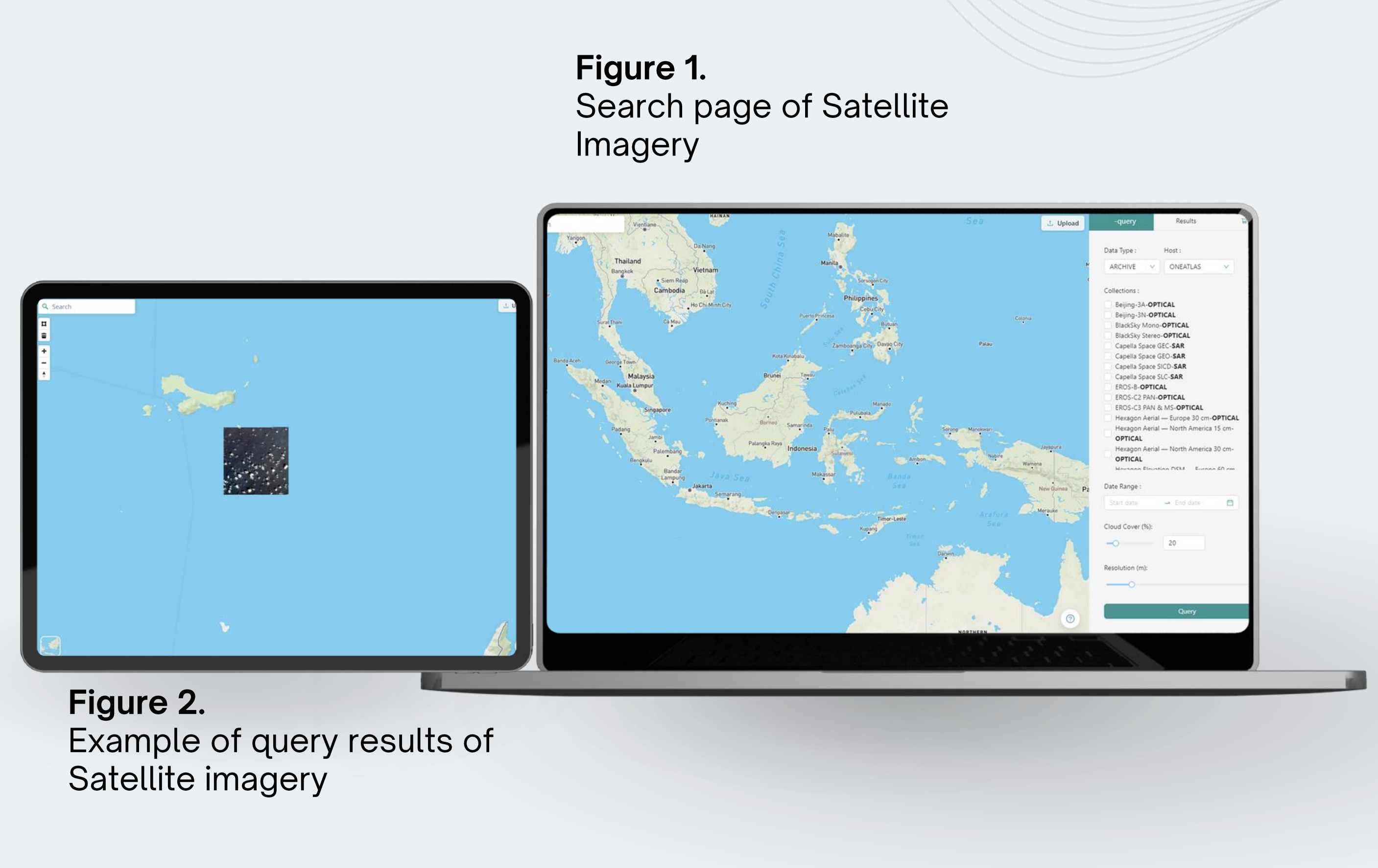
Satellite Imagery Explorer
Built a satellite imagery discovery and order management platform with intuitive search capabilities, enabling streamlined access to geospatial datasets.
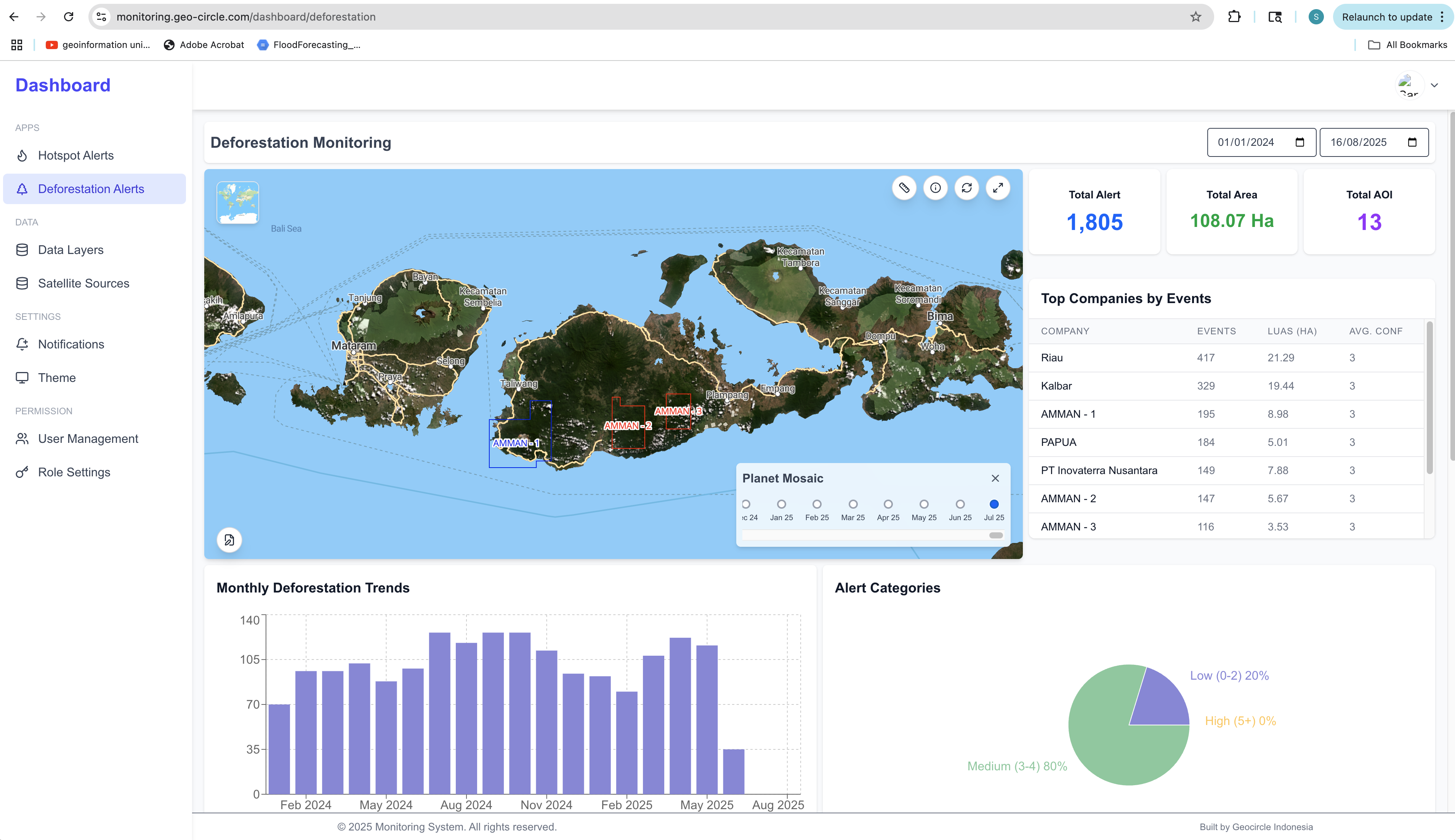
Land Monitoring Full Stack
Designed and deployed a full-stack land monitoring dashboard with automated deforestation alerts, integrating Next.js, Geoserver, and GCP cloud services.

Satellite Imagery Sales Assistant
Developed an AI-powered virtual assistant to guide clients in selecting and estimating satellite imagery needs, integrating OpenAI and WhatsApp automation.